OS1/10/21/43


| List of names as written | Various modes of spelling | Authorities for spelling | Situation | Description remarks |
|---|---|---|---|---|
| DRUMLOFF | Drumloff Drumloff Drumloff Drumloff Drumloff |
James Broom Esqr. William Broom Esqr. Thomas Little Valuation Rolls Johnston's County map |
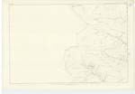
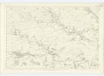
030 | [Situation] 3⅓ miles N W [North West] from Minnyhive A Farmhouse and outbuildings with garden and lands attached, the property of James Broom Esqr. . |
| DALWHAT WATER | Dalwhat Water Dalwhat Water Dalwhat Water |
James Broom Esqr. William Broom Esqr. Thomas Little |
020; 029; 030 | [Situation] From N [North] point of Parish running S E. [South East] to a point ½ mile South from Moniaive A Small River formed by the confluence of Kernhead Dibbon and Glenjaan Burns, and afterwards in its meanderings along the vally, every where flows between wooded banks. |
Continued entries/extra info
[Page] 43,Parish of Glencairn -- Plan 30.5 Trace 4
[Signed] Philip Munro
Pt. RS&M [Private Royal Sappers and Miners]
Transcriber's notes
Dalwhat Water - Authorities - there is a faint 4th entry Johnston's Map (and Dalwhat Water in the Various modes of Spelling column)NB: Descriptive Remarks - a previous transcriber has written 'Fernhead' (Burn) on p.24 and 27. Compare the way Munro writes his 'F' in 'Farmhouse' in the Drumloff entry and 'K' in e.g. (Upper) 'Kirkcudbright' p.163, or 'Knowe' on p30 or 32. Unfortunately, there doesn't seen to be any other entries for Kernhead (or Kirnhead) or Fernhead in SP and I can't find these names on the maps
Transcribers who have contributed to this page.
mac1
Location information for this page.