OS1/10/17/7


| List of names as written | Various modes of spelling | Authorities for spelling | Situation | Description remarks |
|---|---|---|---|---|
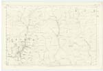
| PEAT HILL | Peat Hill | William Scott Shepherd Garwaldsheils John Davidson Shepherd Blackesk Head |
025 | [Situation] About 1/2 Mile South of Wet Slack A considerable hill situate to the south of Mid Height on its highest point there is a Trigl. [Trigonometrical] station called Peat Hill near which the parish boundary between Eskdalemuir and Hutton and Corrie passes; its surface is covered with heathy pasture |
| CAIRN KNOWE | Cairn Knowe | William Scott Shepherd Garwaldsheils John Davidson Shepherd Blackeskhead |
025 | [Situation] North Side of Peat Hill A small knowe the surface of which is covered with rough pasture, situated on "Peat Hill" a little to the south of "Wet Slack" on the farm of Garwald. On its highest point there is a cairn of stones. |
Continued entries/extra info
[Page] 7Parish of Eskdalemuir
Sheet 25 No. 3 Trace 3
Transcribers who have contributed to this page.
CorrieBuidhe- Moderator, tyshapuzzle
Location information for this page.
Linked mapsheets.