OS1/10/17/60


| List of names as written | Various modes of spelling | Authorities for spelling | Situation | Description remarks |
|---|---|---|---|---|
| DINNINGS HEIGHTS | Dinnings Heights | James Moffat. Farmer. Garwald. | 026 | [Situation] About 1/2 Mile S.W. [South West] of Whitestone Edge An extended ridge of elevated ground running South from Whitestone Edge, & to the west of Muckle Knowe. It is situated on the farm of Garwald, and covered with rough pasture. |
| MUCKLE KNOWE | Muckle Knowe. | James Moffat. Farmer. Garwald. Thomas Douglas. Farmer Craighaugh |
026 | [Situation] About 30 Chains South of Whitestone Edge A inconsiderable elevation to the east of Dinnings Heights and South of Whitestone Edge. It is situated on the farm of Craighaugh, and is covered with rough pasture. |
Continued entries/extra info
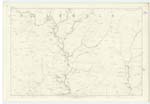
[Page] 60Parish of Eskdalemuir
Sheet 26 No. 5 Trace 4
Transcribers who have contributed to this page.
CorrieBuidhe- Moderator, gengirl44
Location information for this page.
Linked mapsheets.