OS1/10/14/144


| List of names as written | Various modes of spelling | Authorities for spelling | Situation | Description remarks |
|---|---|---|---|---|
| DURISDEER RIG | Durrisdeer Rigg Durrisdeer Rigg Durrisdeer Rigg |
Adam Lockart William Rae Robert Laidlaw |
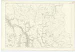
014 | [Situation] In En. [Eastern] Parish district from Wall Height SW. [South West] to Bellstane Shoulder An elevated ridge running along the east side of the Wall Path. |
| WALL HEIGHT | Wall Height Wall Height Wall Height |
Adam Lockart William Rae Robert Laidlaw |
014 | [Situation] At N.En [North Eastern] extremity of Durisdeer Rigg. A portion of Durisdeer Rigg which attains to a greater elevation than the other parts. |
| KIRK GRAIN | Kirk Grain Kirk Grain Kirk Grain |
Adam Lockart William Rae Robert Laidlaw |
014 | [Situation] On S.Wn. [South Western] slope of Durisdeer Rigg A deep glen through which a Stream flows - the Glen & name Commences at the County By. [Boundary] & terminates where it Joins the Black Grain. |
Continued entries/extra info
[Page] 144Durisdeer Ph. [Parish] -- Plan 14.12 Trace No. 2
Wall Height [note] See note in pages 99-95-
[Signed] Owen Barrett
Transcribers who have contributed to this page.
CorrieBuidhe- Moderator, Chr1smac -Moderator, Brenda Pollock
Location information for this page.
Linked mapsheets.