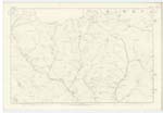
OS1/10/6/54
| List of names as written | Various modes of spelling | Authorities for spelling | Situation | Description remarks |
|---|---|---|---|---|
| GLENBUITH | Glenbuith Glenbuith Glenbuith |
Adam Menzies George Harper James Thomson |
023 | [Situation] At the S,E, [South East] of Garroch Fell, A deep precipitous glen through which a burn flows And falls into Garrock Water |
| GARROCH WATER | Garrock Water Garrock Water Garrock Water Garroch Water Garroch Water Garroch Water Garroch Garroch |
Adam Menzies George Harper James Thomson Joseph Brown Thomas Nevison John Mitchell Valuation Roll 1856 Blackwoods Co [County] Map |
023 | [Situation] From the N,En [North Eastern] side of Auchenleck Hill, S.E, by S, [South East by South to [--] Burn, A stream rising in the north West of Closeburn and flowing in an easterly direction falls into the Water of Ae |
| RASHY HEIGHT | Rashy Height Rashy Height Rashy Height |
Adam Menzies George Menzies James Thomson |
023 | [Situation] On S,En [South Eastern] slope of Auchenleck Hill. A name applied to a portion of the high [lying] land on the Farm of Townhead, This place is also known as "Fell End". |
Continued entries/extra info
[page] 54Parish of Closeburn -- Sheet 23.9 -- Trace 2
[Note Glenbuith] -- Probably a compound of
Glen & buouth - literally the valley of
rage - the adjunct having reference to the stream
which during rain [rushes along the glen with great [impetous]
[Note Rashy Height - Rashy - Covered with Rushes -- Dr [Doctor] Jamieson's Dictionary
[Pencil note] -- (Tumulus) written on the Plan
[signed] John Houston
Transcribers who have contributed to this page.
Chr1smac -Moderator, Moira L- Moderator
Location information for this page.
Linked mapsheets.


