OS1/5/27/8


| List of names as written | Various modes of spelling | Authorities for spelling | Situation | Description remarks |
|---|---|---|---|---|
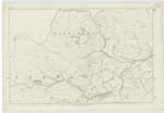
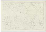
| LAMMERMOOR HILLS | Lammermoor Hills - Continued | Map of Berwickshire. Fullerton's Gazeteer of Scotland New Statistical Acct. [Account] of Berwickshire Chalmers' Caledonia |
009; 015; 016 | [continued] Primary micaceous schist Comp [composes] the entire range, not only of th [the] Lammermoors, but of the heights [which] Continue through Peebleshire till [it joins] the metaliferous mountains about t [the source] of the Clyde. Lammerlaw which r [rises in] the parish of Lauder and gives na [name to] the whole range has an altitude [of] 1. 500 feet. Among other Chief or remarkable summits, according to [the] measurements of Blackadder in his s [survey of] Berwickshire, Criblaw, has an ele [elevation] of 1615 feet; Clinthill 1544; Tippet Knowes 1323; Manslaughterlaw 1273; Twinl [Twinlaw] 1260; Earlstonhill 1200; Great Dirringtonlaw 1145; Ayrhousehill 1054; Bemer [Bemersyde] hill 1011; and Cockburnlaw 912. -- Fullerton's Gazeteer of Scotland Page 206. |
Continued entries/extra info
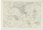
[page] 8Parish of Langton
Transcriber's notes
Words lost in fold of page.Transcribers who have contributed to this page.
Moira L- Moderator
Location information for this page.