OS1/5/25/54


| List of names as written | Various modes of spelling | Authorities for spelling | Situation | Description remarks |
|---|---|---|---|---|
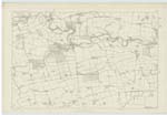
| WHITEADDER WATER | Whiteadder Water | Map of Berwickshire Revd [Reverend] Mr Davison Abbey St. [Saint] Bathans Peter Donaldson. Elmford General Usage |
017 | A river, or as it is termed water which takes its rise in the Lammermoor Hills in Haddingtonshire, at a place called Whitewell, & flowing in a South Easterly direction, empties itself into the Tweed a little S.W. [South West] of the town of Berwick upon Tweed_ this river or water rises in one of the wildest districts in the South of Scotland, and in its course passes through varied scenery - sometimes through flat Haughs - but generally through places where the hills close in, so as to narrow the Valley almost to the bed of the river - at Preston Mill & Haugh, the river escapes from the wild rocky, mountainous country - entering the beautiful valley in which the Tweed runs - the richest fields succeed the narrow waste, woodlands, orchards & highly cultivated grounds bespeak wealth & comfort - The river itself partakes of the character of the country running in gentle streams over Pebbly beds, alternating with long Reaches of Still Water _ |
Continued entries/extra info
[Page] 54Parish of Hutton -- Described by W. Beatty
[Signed] R. Burnaby Capn [Captain] RE [Royal Engineers] 31 Jan [January] 1857
Transcribers who have contributed to this page.
ron hill
Location information for this page.
Linked mapsheets.