OS1/5/6/12B


| List of names as written | Various modes of spelling | Authorities for spelling | Situation | Description remarks |
|---|---|---|---|---|
| NINECAIRN EDGE | Ninecairn Edge Ninecairn Edge Ninecairn Edge |
Mr Peter Gibson Oxton Mr William Renwick Kelphope Mr Andrew Laidlaw Friars Nose |
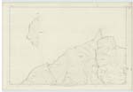
007 | A hill covered with heathy pasture in the farm of Kelphope, and situated about half a-mile north west of Kelphope Hill; it forms part of the boundary between the counties of Berwick and Haddington. |
| LINDEAN BURN | Linndean Burn Linndean Burn Linndean Burn |
Mr James Hope Kirktonhill Mr Peter Gibson Mr ANdrew Laidlaw |
007 | Linndean Burn rises on the west side of the hill known as Ninecairn Edge, and runs in a south easterly direction for about a mile, near to Hunter's Hall (Inn) where it takes a northerly direction for a considerable distance and falls into the Tyne Water; from its source for about a mile it forms the boundary between the counties of Haddington and Berwick. |
Continued entries/extra info
[page] 12bParish of Ormiston -- Sheet 10 -- Described by Sapper Montgomery R.E. [Royal Engineers]
Transcribers who have contributed to this page.
Moira L- Moderator, CharlesJaffrey, krazykaka
Location information for this page.