OS1/3/60/135


| List of names as written | Various modes of spelling | Authorities for spelling | Situation | Description remarks |
|---|---|---|---|---|
| ANTEFOUNTAIN BURN | Antefountain Burn Antefountain Burn Antefountain Burn Altifountain Burn |
Mr William McClive John Blair Matthew Young Johnston's County Map |
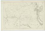
052 | A rapid stream which rising at the base of a height called Pinverains flows westward to Tairlaw Burn. |
| DRUMFAD | Drumfad Drumfad Drumfad Drumfadd |
Mr William McClive John Blair Matthew Young Johnston's County Map |
052 | A small pasture hill, trigl. [Trigonometrical] station on its summit. It was, sometime ago, a small possession, but since merged in the farm of Tairlaw. A farmsteading bearing the name of Drumfad stood upon it, but its site is destroyed |
Continued entries/extra info
[Page] 135Ph. [Parish] of Straiton
Transcribers who have contributed to this page.
hillhere
Location information for this page.
Linked mapsheets.