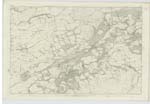
OS1/3/19/1/73


| List of names as written | Various modes of spelling | Authorities for spelling | Situation | Description remarks |
|---|---|---|---|---|
| MAXWELLSTON HILL | Maxwellston Hill Maxwellston Hill Maxwellston Hill Maxwellston Hill Maxwellstonhill |
Thomas Scott William McCulloch Ivie Willet J.B. Ross Esq Factor Johnston's County Map |
050 | The western end of Hadyard Hill on which are the Remains of an encampment. The North face of this hill is Steep but towards the east The declivity is Scarcely perceptible to the S. [South] & W. [West] it falls of gently - Property of the Duchesse de Coigney. |
| CURRAH GLEN | Currah Glen Currah Glen Currah Glen Currah Glen |
Thomas Scott Wiliam McCulloch Ivie Willet J.B. Ross Esq |
050 | A narrow and Thickly wood glen through which flows a Small Stream. It derives its Name from the Circumstance of its having been once the boundary between the farms of Curraw & Maxwellston. Property of the Duchess de Coigney - |
| LINNET GLEN | Glenlinnet Glen Glenlinnet Glen Glenlinnet Glen Glenlinnet Glen |
Thomas Scott William McCulloch Ivie Willet J.B. Ross Esq |
050 | A Steep, narrow and thickly wooded glen Through which flows a Small Stream. It derives its name from the Circumstance as it is Said of its being the resort of great numbers of green linnets - There was a farmstead of this name in the vicinity but has long been removed. Property of the Duchess de Coigney |
Continued entries/extra info
[Page] 73Sheet 50.15 -- Parish of Dailly
Transcribers who have contributed to this page.
Chr1smac -Moderator, JCB
Location information for this page.
Linked mapsheets.