OS1/3/19/1/3


| List of names as written | Various modes of spelling | Authorities for spelling | Situation | Description remarks |
|---|---|---|---|---|
| LADY BURN | Ladyburn Ladyburn Ladyburn |
P. Richardson F.C. Mins. [Free Church Minister] Ivie Willet Parochial Teacher James Hope Esqr. |
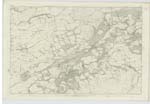
050 | Is a narrow winding stream rising near the base of Kirkhill on the South side & running through a beautiful Glen (in which there have been some rare fossils found within these last few years) where it forms the boundary between Kirkoswald & Dailly for a considerable way. |
| KIRK HILL | Kirk Hill Kirk Hill Kirk Hill |
P. Richardson F.C. Mins. [Free Church Minister] Ivie Willet Parochial Teacher James Hope Esqr. |
050 | Is a beautiful heathy pasture hill rising rather abruptly in the South West side; having on its summit a "hill fort" or "Clun" evidently belonging to the ancient Britons stone coffin found about 60 years ago |
| OLD FORT (Remains of) [Kirk Hill] | 050 | A single Rampart and ditch are all that remain of this "hill fort" having a diameter of about 150 feet. | ||
| TUMULUS [Kirk Hill] | 050 | The interior tumulus rises about 20 feet above the level of the rampart, ( which is about 3 feet high) in a mound or mash like form terminating in a flat level top of about 30 feet in diameter. On this top the inhabitants point out several oblong mounds which tradition says are the graves of some of their heroes, which must be purely supposition, and very improbable also, for at the present time there are not more than six inches of earth covering a hard reddish coloured sandstone, which appears to form the principal surface rock for the entire hill. _ Rock not [stratified ?] |
Continued entries/extra info
[Page] 3Ph. [Parish] of Dailly
Transcribers who have contributed to this page.
Chr1smac -Moderator, DANIALSAN
Location information for this page.
Linked mapsheets.