OS1/1/81/76


| List of names as written | Various modes of spelling | Authorities for spelling | Situation | Description remarks |
|---|---|---|---|---|
| DOUNE OF INVERNOCHTY | Doune of Invernochty Doune of Invernochty Doun of Invernochtie Dun of Invernochty The Down |
Statistical Account 1843 Revd [Reverend] John Watt The Manse Collections of the Shires. Mr A.G. Anderson. Schoolmaster Estate Plan 1823 |
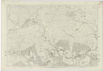
060 | "Doune, a short way above the confluence of the Nochty and Don, there is a very remarkable abruptly Conical mound about 60 feet in height from the bottom of the ditch 970 feet in Circumference at the base, and 562 feet at the top. It is of an oval form, and the flat Surface on the top measures about half an acre It has been regularly fortified by a moat 16 feet deep and 26 feet wide at the bottom, which has been Supplied with water from the Stream Bardock, It has evidently been one of those gravelly eminences already mentioned, and probably the cutting of the wet ditch, and the more regular formation of the Sides is all that is artificial about it. Its situation and figure pointed it out as a place on which to erect a stronghold. All around the top the foundations of buildings are visible, There is no account of this remnant of antiquity. Some vague tradition states the Church originally stood here, which merely rests on the former name of the parish being Invernochtie, It has been a place of considerable strength in a remote age. Chalmers mentions traces of a Roman Iter from Deeside which would point precisely in this direction, The traces of science in fortification would Support the conjecture. that it might be a Roman fort, to preserve the line of Communication across the Country" vide Statistical account 1843 Page 543 &c In 1855 Mr A Walker, Gardener of Newe. made some excavations here, and found at the bottom of the moat, what evidently had been the drawbridge, formerly used, two large pieces of timber about. 28 feet long. by 18 inches square of black oak. not likely to have grown in this locality. The main entrance or gateway was also made visible and Some foundations of buildings on the Summit. A stone wall appears to have been erected around the top, and the house &c in the interior, an iron key and a Small dirk. about 6 or 8 inches long. were also found at the bottom of the moat at the date mentioned. |
Continued entries/extra info
[Page] 76Parish of Strathdon
[Note beside 'Doune of Invernochty']
Note. This object is very similar to the "Bass" at Inverurie, also in this County. It probably had on its summit one of those 14th century wooden castles, originally, called "lignese ministeries" in early writers. The remains now to be traced on it are of much later erection. In my opinion it has no connection at all with the Romans. [Signed] E.H. Courtney Capt. R.E. [Captain Royal Engineers]
Transcribers who have contributed to this page.
Moderator - NRS, CorrieBuidhe- Moderator, ElaineF
Location information for this page.
Linked mapsheets.