OS1/1/74/1


| List of names as written | Various modes of spelling | Authorities for spelling | Situation | Description remarks |
|---|---|---|---|---|
| PITSLIGO | Pitsligo Parish Pitsligo Parish Pitsligo Parish Pitsligo Parish Pitsligo Parish |
Old Statistical Account New Statistical Account Johnstons County Map Johnstons Royal Atlas County Directory |
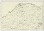
002 | A Parish situated in the eastern division of Aberdeenshire, it is bounded on the north by the Moray Frith, on the East by the parish of Fraserburgh, on the South by the parish of Tyrie and on the West by the parish of Aberdour. "The name of this parish was derived from the estate of Lord Pitsligo of whose lands it was originally composed, and signifies in Gaelic 'Hollow Shell'. The parish contains about 9 Square miles, is of the figure of a trapezoid and one of the most compact in Buchan. The extent of Coast is about 4 miles. The Shore on the eastern half extending from the burgh of Rosehearty to the confines of the parish of Fraserburgh is partly sand and partly rock, loose and flat: the western half extending from Rosehearty to the confines of the parish of Aberdour, consists of high & bold rocks, full of fissures of great extent and depth". The parish Church stands in the very centre of the parish, where the Strichen and old Banff roads intersect each other. It was built in the year 1634, and is at present in good repair."** New Statistical Account |
Continued entries/extra info
[Page] 1Note. There is not any portion of this parish Detached, nor is there any portion of any other parish contained within the boundary of this parish.
Transcribers who have contributed to this page.
CorrieBuidhe- Moderator, Kcat
Location information for this page.
Linked mapsheets.