OS1/1/19/76


| List of names as written | Various modes of spelling | Authorities for spelling | Situation | Description remarks |
|---|---|---|---|---|
| n- CREAG PHIOBAIDH | Creag Phiobadh Creag Phiobadh Creag Phiobadh |
Revd [Reverend] J Campbell Mr Mitchell Mr Gordon |
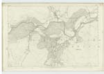
091 | [Situation] In the Ph. [Parish of Crathie and Braemar. A large hill chiefly covered with heathy pasture, situated on the S [South] side of the Dee, and on the E. [East] of the Girnoch Burn, and about one mile N W [North West] of Creag Liath. It means the "Piping Craig". |
| TOM AN LAGAIN | Tom an Lagain Tom an Lagain Tom an Lagain |
Revd [Reverend] J. Campbell Mr Mitchell Mr W. Gordon |
091 | [Situation] In the Ph. [Parish] of Glenmuick Tullich and Glengairn. A large Knowe, situated on the E [East] side of the Girnoch Burn and about mid-way on the ridge connecting Creag Phiobadh, and Creag Leath. It means "Hillock of the hollow". |
| GIRNOCK BURN | Girnock Burn Girnock Burn Girnock Burn Girnock Burn Girnock Burn Girnag Water |
Revd [Reverend] Mr Smith Mr J. Grant Revd [Reverend] J Campbell Mr Mitchell Mr W Gordon Black's Map |
091 | [Situation] Between the Phs. [Parishes] of Crathie and Braemar, and Glenmuick Tullich and Glengairn. A large hill stream about five miles long, rising in the Moorland near the parish boundary north of Glen Craig [see Sheet 99]. Its general course is northerly, until it falls into the Dee about two miles above Ballater village. |
Continued entries/extra info
[Page] 76Aberdeenshire
Glenmuick Ph [Parish]
Transcribers who have contributed to this page.
Kate51- Moderator, Kirk Beadle
Location information for this page.
Linked mapsheets.