OS1/1/17/17


| List of names as written | Various modes of spelling | Authorities for spelling | Situation | Description remarks |
|---|---|---|---|---|
| CAIRN TOUL | Cairntoul Cairntoul Cairntoul Cairntoul Cairntoul Cairn-toul Cairntoul Cairn-toul |
Mr. Alexander McDonald Glenlui Braemar New Statistical Account Mr. John Grant Inverey Braemar Mr. John Morgan Teacher Inverey Braemar Donside Guide Black's Map of Scotland Keith's Aberdeenshire Johnston's County Map |
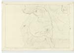
087 | This is a large sharp tipped Mountain situated southward from Braeriach and divided from it by the glen through which Allt Grabhecoire flows. Its height as shown by Black's Large Map of Scotland is 4245 feet. |
| ALLT A' GHARBH-CHOIRE | Allt a' Gharbh-choire Allt a' Gharbh-choire Allt a' Gharbh-choire Garrochorry Burn Garrochory Burn |
Mr. Alexander McDonald Mr. John grant Mr. John Morgan Black's Map of Scotland Johnstons County Map |
087 | This burn rises about 1¼ miles south west from the higest peak of Braeriach. Its general course is easterly. It joins Allt Larig Grumach & then takes the name of River Dee. This stream forms the main source of the Dee. (Name signifies the Burn of the Rough Hollow. |
Continued entries/extra info
[Page] 17Aberdeenshire - Crathie & Braemar
[Note]
ALLT A' GHARBH-CHOIR
The authorities agree to the alterations in this page.
Transcribers who have contributed to this page.
Trondragirl- Moderator, georgelaidlaw
Location information for this page.
Linked mapsheets.