
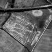
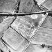
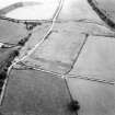
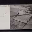
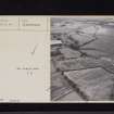
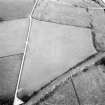
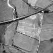
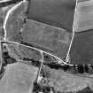
Oblique aerial view.
View in Canmore
View in Canmore

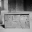
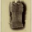
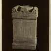
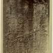
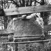
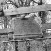
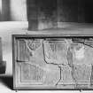
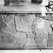
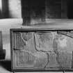
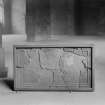
Inscribed stone found at Birrens Roman Fort, now in the National Museum of Scotland.
View in Canmore
View in Canmore

Oblique aerial view.
View in Canmore
View in Canmore

Oblique aerial view.
View in Canmore
View in Canmore

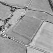
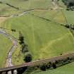
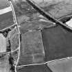
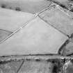
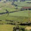
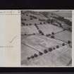
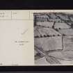
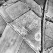
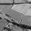
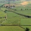
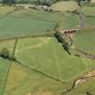
Oblique aerial view of Birrens, taken from the NNW, centred on a Roman Fort.
View in Canmore
View in Canmore

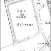
Birrens as depicted on the 2nd edition of the OS 25-inch map in the middle of the 19th century.
View in Canmore
View in Canmore

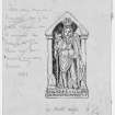
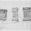
Publication drawings; Roman altars and brigantia, Birrens
View in Canmore
View in Canmore

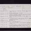
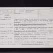
Birrens, NY27NW 4, Ordnance Survey index card, page number 4, Recto
View in Canmore
View in Canmore

Birrens, NY27NW 4, Ordnance Survey index card, page number 1, Recto
View in Canmore
View in Canmore

Birrens, NY27NW 4, Ordnance Survey index card, Recto
View in Canmore
View in Canmore

Birrens, NY27NW 4, Ordnance Survey index card, inset open, Recto
View in Canmore
View in Canmore

Oblique aerial view.
View in Canmore
View in Canmore

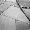
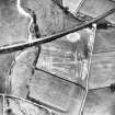
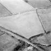
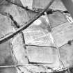
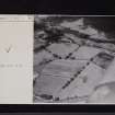
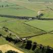
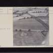
Oblique aerial view of the Roman fort at Birrens.
View in Canmore
View in Canmore

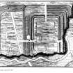
Alexander Gordon's plan of the Roman fort at Birrens (1726, pl. 2).
View in Canmore
View in Canmore

Birrens, NY27NW 4, Ordnance Survey index card, Verso
View in Canmore
View in Canmore

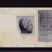
Inscribed stone found at Birrens, now in the National Museum of Scotland.
View in Canmore
View in Canmore

Oblique aerial view.
View in Canmore
View in Canmore

Oblique aerial view.
View in Canmore
View in Canmore

Oblique aerial view.
View in Canmore
View in Canmore

View of Roman altar to Harimella at Hoddam Castle, originally found at Birrens Roman fort.
View in Canmore
View in Canmore

View of Roman altar to Viradecthis at Hoddam Castle, originally found at Birrens Roman fort.
View in Canmore
View in Canmore

View of Roman altar to Minerva and a smaller altar in the lobby of Burnfoot House, originally presumably found at Birrens Roman fort.
View in Canmore
View in Canmore

Detailed view of inscribed stone annotated on back 'Hoddam Church'.
View in Canmore
View in Canmore

Birrens, NY27NW 4, Ordnance Survey index card, page number 5, Recto
View in Canmore
View in Canmore

Birrens, NY27NW 4, Ordnance Survey index card, inset closed, Recto
View in Canmore
View in Canmore

Birrens, NY27NW 4, Ordnance Survey index card, Recto
View in Canmore
View in Canmore

Birrens, NY27NW 4, Ordnance Survey index card, Verso
View in Canmore
View in Canmore

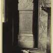
View of pedestal of Roman altar.
View in Canmore
View in Canmore

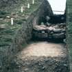
Copy of colour slide, Birrens Roman Fort Rampart section.
NMRS Survey of Private Collection
Digital Image Only
View in Canmore
View in Canmore

Pedestal of Roman altar found in Knockhill Summerhouse, thought to be from Birrens Roman Fort.
View in Canmore
View in Canmore

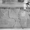
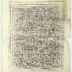
Roman Latin votive inscription from Birrens.
View in Canmore
View in Canmore

Oblique aerial view.
View in Canmore
View in Canmore

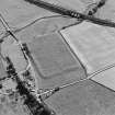
Oblique aerial view of the Roman fort at Birrens.
View in Canmore
View in Canmore

Birrens as depicted by General Roy (1793, pl. xxiv).
View in Canmore
View in Canmore

Birrens, NY27NW 4, Ordnance Survey index card, Recto
View in Canmore
View in Canmore

Birrens, NY27NW 4, Ordnance Survey index card, Recto
View in Canmore
View in Canmore

Inscribed stone found at Birrens, now in the National Museum of Scotland.
View in Canmore
View in Canmore

Inscribed stone found at Birrens, now in the National Museum of Scotland.
View in Canmore
View in Canmore

Inscribed stone found at Birrens, now in the National Museum of Scotland.
View in Canmore
View in Canmore

Oblique aerial view.
View in Canmore
View in Canmore

Oblique aerial view.
View in Canmore
View in Canmore

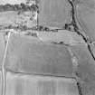
Oblique aerial view of Birrens, taken from the NE, centred on a Roman Fort. A watermill, situated to the E of the fort is visible in the bottom left-hand corner of the photograph.
View in Canmore
View in Canmore

Oblique aerial view of Birrens, taken from the W, centred on a Roman Fort. A watermill, situated to the E of the fort is visible in the top left-hand corner of the photograph.
View in Canmore
View in Canmore

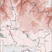
Map showing the distribution of Roman monuments in Annandale and Eskdale. Published in Eastern Dumfriesshire: an archaeological landscape.
View in Canmore
View in Canmore

Birrens, NY27NW 4, Ordnance Survey index card, page number 2, Verso
View in Canmore
View in Canmore

Birrens, NY27NW 4, Ordnance Survey index card, page number 1, Recto
View in Canmore
View in Canmore

Birrens, NY27NW 4, Ordnance Survey index card, page number 2, Recto
View in Canmore
View in Canmore
Imagery and Mapping Files for Aerial Photo Transcription.
View in Canmore
View in Canmore

Birrens, NY27NW 4, Ordnance Survey index card, inset open, Recto
View in Canmore
View in Canmore

Oblique aerial view.
View in Canmore
View in Canmore

Oblique aerial view of Birrens, taken from the N, centred on a Roman Fort. A watermill, situated to the E of the fort is visible in the bottom right-hand corner of the photograph.
View in Canmore
View in Canmore

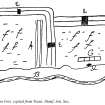
Plan of Birrens by Sir John Clerk of Penicuik (after Prevost 1961b).
View in Canmore
View in Canmore

Birrens, NY27NW 4, Ordnance Survey index card, Verso
View in Canmore
View in Canmore

Birrens, NY27NW 4, Ordnance Survey index card, Verso
View in Canmore
View in Canmore

Birrens, NY27NW 4, Ordnance Survey index card, Recto
View in Canmore
View in Canmore

Oblique aerial view of Birrens Roman Fort.
View in Canmore
View in Canmore

Inscribed stone found at Birrens, now in the National Museum of Scotland.
View in Canmore
View in Canmore

Oblique aerial view.
View in Canmore
View in Canmore

Oblique aerial view of the Roman fort at Birrens.
View in Canmore
View in Canmore

Oblique aerial view of the Roman fort at Birrens.
View in Canmore
View in Canmore

Oblique aerial view of the Roman fort at Birrens.
View in Canmore
View in Canmore

Birrens, NY27NW 4, Ordnance Survey index card, page number 3, Recto
View in Canmore
View in Canmore

Birrens, NY27NW 4, Ordnance Survey index card, Recto
View in Canmore
View in Canmore

Birrens, NY27NW 4, Ordnance Survey index card, Recto
View in Canmore
View in Canmore

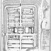
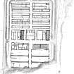
Publication drawing: plan of Roman fort, Birrens, with elevation of storehouse C3.
View in Canmore
View in Canmore

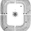
The plan of the Roman fort at Birrens drawn by James Barbour as a result of the excavations of 1895 (Macdonald and Barbour 1897, pl. Ia).
View in Canmore
View in Canmore

Publication drawings; Roman altars and brigantia, Birrens
View in Canmore
View in Canmore

Publication drawing; Roman dedicatory tablet, Birrens.
View in Canmore
View in Canmore

Birrens, NY27NW 4, Ordnance Survey index card, inset open, Recto
View in Canmore
View in Canmore



You may copy, display, store and make derivative works for personal use or use solely within an educational institution by staff and students, under these conditions: the ScotlandsPlaces website is attributed, there is no commercial use or sale, and no public distribution (for example, by hand, email, or web). Full licence details.
Details
Organisation: Historic Environment Scotland (HES)
Alternative name(s): Blatobulgium
Canmore ID: 67099
Site type: Roman Fort (roman)
County: Dumfries-shire
Parish: Middlebie
Council: Dumfries And Galloway


