
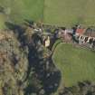
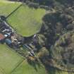
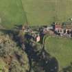
Stoneypath Tower


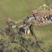
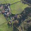
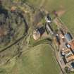
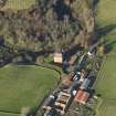
Oblique aerial view of Stoneypath Tower with farmstead adjacent, taken from the WNW.
View in Canmore
View in Canmore

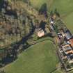
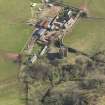
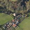
Oblique aerial view centred on the tower house with the farmstead adjacent, taken from the SSW.
View in Canmore
View in Canmore

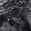
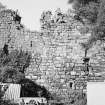
Interior.
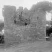
General view.
View in Canmore
View in Canmore

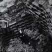
Interior.
General view.
View in Canmore
View in Canmore

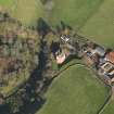
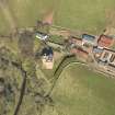
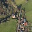
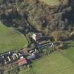
Oblique aerial view centred on the tower house with the farmstead adjacent, taken from the SW.
View in Canmore
View in Canmore

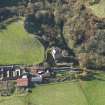
Oblique aerial view centred on the tower house with the farmstead adjacent, taken from the S.
View in Canmore
View in Canmore

Oblique aerial view of Stoneypath Tower with farmstead adjacent, taken from the SW.
View in Canmore
View in Canmore

Oblique aerial view centred on the tower house with the farmstead adjacent, taken from the E.
View in Canmore
View in Canmore

Oblique aerial view centred on the tower house with the farmstead adjacent, taken from the N.
View in Canmore
View in Canmore

View from E.
View in Canmore
View in Canmore

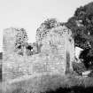
General view.
View in Canmore
View in Canmore

Oblique aerial view of Stoneypath Tower with farmstead adjacent, taken from the SSW.
View in Canmore
View in Canmore

Oblique aerial view centred on the tower house with the farmstead adjacent, taken from the NE.
View in Canmore
View in Canmore

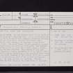
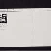
Stoneypath Tower, NT57SE 11, Ordnance Survey index card, page number 1, Recto
View in Canmore
View in Canmore

Stoneypath Tower, NT57SE 11, Ordnance Survey index card, Recto
View in Canmore
View in Canmore

Oblique aerial view centred on the tower house with the farmstead adjacent, taken from the SSE.
View in Canmore
View in Canmore

Oblique aerial view centred on the tower house with the farmstead adjacent, taken from the SE.
View in Canmore
View in Canmore

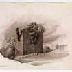
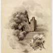
View of Stonypath Tower.
View in Canmore
View in Canmore

Stoneypath Tower, NT57SE 11, Ordnance Survey index card, Recto
View in Canmore
View in Canmore

Oblique aerial view of Stoneypath Tower with farmstead adjacent, taken from the NNW.
View in Canmore
View in Canmore

Oblique aerial view centred on the tower house with the farmstead adjacent, taken from the W.
View in Canmore
View in Canmore

Oblique aerial view centred on the tower house with the farmstead adjacent, taken from the SE.
View in Canmore
View in Canmore

View from S of Stoneypath Tower.
View in Canmore
View in Canmore

Oblique aerial view centred on the tower house with the farmstead adjacent, taken from the ESE.
View in Canmore
View in Canmore

View of Stonypath Tower.
View in Canmore
View in Canmore
You may copy, display, store and make derivative works for personal use or use solely within an educational institution by staff and students, under these conditions: the ScotlandsPlaces website is attributed, there is no commercial use or sale, and no public distribution (for example, by hand, email, or web). Full licence details.
Details
Organisation: Historic Environment Scotland (HES)
Alternative name(s):
Canmore ID: 56401
Site type: Dovecot (period Unassigned), Tower House (medieval)
County: East Lothian
Parish: Whittingehame
Council: East Lothian