
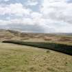
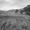
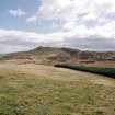
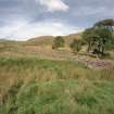
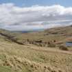
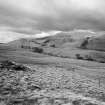
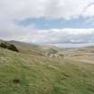
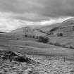
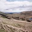
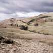
General view of Menstrie Glen from Ashentrool (NS89NW 56.00) looking south-east.
View in Canmore
View in Canmore

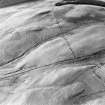
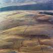
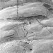
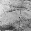
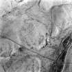
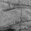
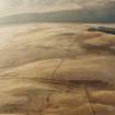
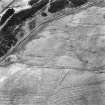
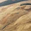
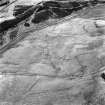
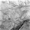
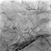
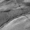
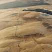
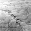
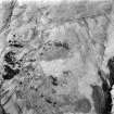
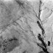
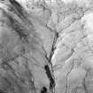
Oblique aerial view of Ashentrool centred on an archaeological landscape, taken from the ESE.
View in Canmore
View in Canmore

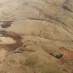
Oblique aerial view of Ashentrool centred on an archaeological landscape, taken from the NE.
View in Canmore
View in Canmore

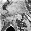
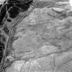
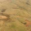
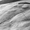
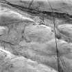
Oblique aerial view.
View in Canmore
View in Canmore

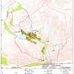
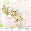
Map showing distribution of settlements in Menstrie Glen before the 1760s. Fig 23 in "Well shelterd & watered" Menstrie Glen, a farming landscape near Stirling.showing property names in Menstrie Glen. Fig 12 in "Well shelterd & watered" Menstrie Glen, a farming landscape near Stirling.
View in Canmore
View in Canmore

Lossburn Reservoir, NS89NW 37, Ordnance Survey index card, Recto
View in Canmore
View in Canmore

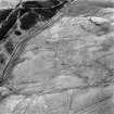
Oblique aerial view of Ashentrool centred on an archaeological landscape, taken from the E.
View in Canmore
View in Canmore

Oblique aerial view of Ashentrool centred on an archaeological landscape, taken from the NE.
View in Canmore
View in Canmore

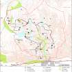
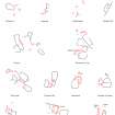
Illustration showing layout of farmsteads in the Menstrie Glen. Fig 31 in "Well shelterd & watered" Menstrie Glen, a farming landscape near Stirling.
View in Canmore
View in Canmore

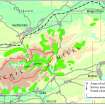
Extent of relict cultivation in the Ochil Hills. Fig 57 in "Well shelterd & watered" Menstrie Glen, a farming landscape near Stirling.
View in Canmore
View in Canmore

Oblique aerial view of Ashentrool centred on an archaeological landscape, taken from the ENE.
View in Canmore
View in Canmore

Oblique aerial view of Ashentrool centred on an archaeological landscape, taken from the WSW.
View in Canmore
View in Canmore

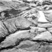
Oblique aerial view.
View in Canmore
View in Canmore

Oblique aerial view.
View in Canmore
View in Canmore

View of farmstead to north.
View in Canmore
View in Canmore

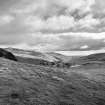
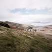
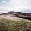
General view of Menstrie Glen from Ashentrool towards Loss.
View in Canmore
View in Canmore

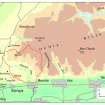
Map of the western end of the Ochils showing the location of Menstrie Glen. Fig 12 in "Well shelterd & watered" Menstrie Glen, a farming landscape near Stirling.
View in Canmore
View in Canmore

General view of Menstrie Glen from Backside of Lipney looking north-west across the glen.
View in Canmore
View in Canmore

General view of Menstrie Glen from Ashentrool (NS89NW 56.00) looking south-east.
View in Canmore
View in Canmore

Oblique aerial view.
View in Canmore
View in Canmore

General view of Menstrie Glen from Ashentrool towards Loss.
View in Canmore
View in Canmore

Crunie Burn, NS89NW 38, Ordnance Survey index card, Recto
View in Canmore
View in Canmore

Oblique aerial view of Ashentrool archaeological landscape, taken from the SW.
View in Canmore
View in Canmore

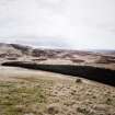
View of the march-dyke between Loss and Ashentrool looking northwards to the W flank of Loss Hill.
The dyke was laid out in 1762. The green rise in the centre of the photograph marks the site of Patrick Henderson's sheep-house, which is mentioned in the description of the march contained in James Wright's papers.
View in Canmore
View in Canmore

Oblique aerial view of Ashentrool centred on an archaeological landscape, taken from the WSW.
View in Canmore
View in Canmore

Map depicting arable land and settlement in the early 19th century. Fig 21 in "Well shelterd & watered" Menstrie Glen, a farming landscape near Stirling.
View in Canmore
View in Canmore

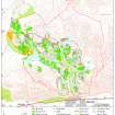
Map showing the extents of different types of rig in Menstrie Glen. Fig 48 in "Well shelterd & watered" Menstrie Glen, a farming landscape near Stirling.
View in Canmore
View in Canmore

General view of Menstrie Glen from Ashentrool (NS89NW 56.00) looking south-east.
View in Canmore
View in Canmore

Oblique aerial view of Ashentrool centred on an archaeological landscape, taken from the NE.
View in Canmore
View in Canmore

Oblique aerial view of Ashentrool centred on an archaeological landscape, taken from the E.
View in Canmore
View in Canmore

Oblique aerial view.
View in Canmore
View in Canmore

Oblique aerial view.
View in Canmore
View in Canmore

General view of Menstrie Glen from Backside of Lipney looking north-west across the glen.
View in Canmore
View in Canmore

General view of Menstrie Glen from Ashentrool (NS89NW 56.00) looking south-east.
View in Canmore
View in Canmore

Oblique aerial view of Ashentrool centred on an archaeological landscape, taken from the E.
View in Canmore
View in Canmore

Oblique aerial view.
View in Canmore
View in Canmore

Oblique aerial view.
View in Canmore
View in Canmore

General view of Menstrie Glen from Ashentrool towards Loss.
View in Canmore
View in Canmore

Oblique aerial view.
View in Canmore
View in Canmore

General view of Menstrie Glen from Backside of Lipney looking north-west across the glen.
View in Canmore
View in Canmore

Oblique aerial view of Ashentrool centred on an archaeological landscape, taken from the E.
View in Canmore
View in Canmore

Oblique aerial view of Ashentrool centred on an archaeological landscape, taken from the SW.
View in Canmore
View in Canmore

Oblique aerial view of Ashentrool centred on an archaeological landscape, taken from the E.
View in Canmore
View in Canmore

Oblique aerial view of Ashentrool centred on an archaeological landscape, taken from the NE.
View in Canmore
View in Canmore

Oblique aerial view of Ashentrool centred on an archaeological landscape, taken from the SW.
View in Canmore
View in Canmore

Oblique aerial view of Ashentrool centred on an archaeological landscape, taken from the SW.
View in Canmore
View in Canmore

Oblique aerial view of Ashentrool centred on an archaeological landscape, taken from the SSE.
View in Canmore
View in Canmore

Oblique aerial view of Ashentrool centred on an archaeological landscape, taken from the NE.
View in Canmore
View in Canmore

Oblique aerial view.
View in Canmore
View in Canmore

Oblique aerial view.
View in Canmore
View in Canmore

General view of Menstrie Glen from Ashentrool (NS89NW 56.00) looking south-east.
View in Canmore
View in Canmore

General view of Menstrie Glen from Ashentrool (NS89NW 56.00) looking south-east.
View in Canmore
View in Canmore

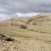
General view to south-east of Menstrie Glen from Ashentrool towards Loss.
Scan of D/59286/CN, ground view of Menstrie Glen. Scanned for Menstrie Glen publication.
View in Canmore
View in Canmore

General view of Menstrie Glen from Ashentrool towards Loss. The stone dyke in the foreground is one of the new land divisions laid out in the 1760's. It marks the march between Ashentrool and Loss and the line of trees leading away on the left of the picture follows the boundary of the emparkemnt established between Loss and Townhead.
View in Canmore
View in Canmore

Map showing distribution of settlements in Menstrie Glen before the 1760s with head-dykes and cultivated ground. Fig 11 in "Well shelterd & watered" Menstrie Glen, a farming landscape near Stirling.
View in Canmore
View in Canmore

Oblique aerial view.
View in Canmore
View in Canmore

Oblique aerial view.
View in Canmore
View in Canmore

General view of Menstrie Glen from Backside of Lipney looking north-west across the glen.
View in Canmore
View in Canmore

General view of Menstrie Glen from Ashentrool (NS89NW 56.00) looking south-east.
View in Canmore
View in Canmore

Loss Hill, NS89NW 39, Ordnance Survey index card, Recto
View in Canmore
View in Canmore




You may copy, display, store and make derivative works for personal use or use solely within an educational institution by staff and students, under these conditions: the ScotlandsPlaces website is attributed, there is no commercial use or sale, and no public distribution (for example, by hand, email, or web). Full licence details.
Details
Organisation: Historic Environment Scotland (HES)
Alternative name(s): Loss Hill
Canmore ID: 144994
Site type: Archaeological Landscape (medieval) - (post Medieval)
County: Stirlingshire
Parish: Logie (stirling)
Council: Stirling


