
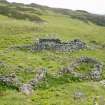
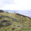
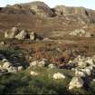
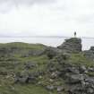
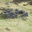
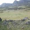
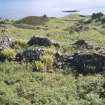
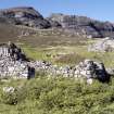
Eigg, Grulin Uachdrach, Township. View of buildings (212,213,214) from NW.
View in Canmore
View in Canmore

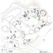
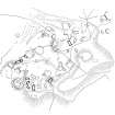
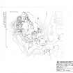
Plan of Grulin township. HES publication illustration.
View in Canmore
View in Canmore

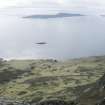
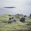
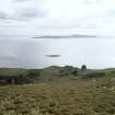
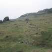
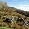
Eigg, Grulin Uachdrach. View of township from An Sgurr.
View in Canmore
View in Canmore

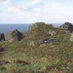
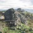
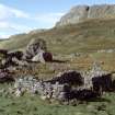
Eigg, Grulin Uachdrach, Township. View of building from NE.
View in Canmore
View in Canmore

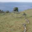
Eigg, Grulin Uachdrach, Township. View of well, possibly St. Catherine's Well.
View in Canmore
View in Canmore

Eigg, Grulin Uachdrach, Township. View of building from NE.
View in Canmore
View in Canmore

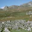
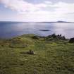
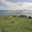
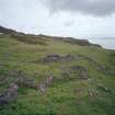
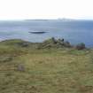
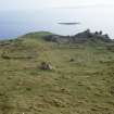
View to the township and dun at Grulin, facing SW.
View in Canmore
View in Canmore

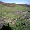
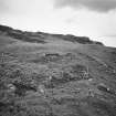
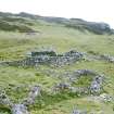
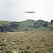
Eigg, Grulin Uachdrach township, view from N.
View in Canmore
View in Canmore

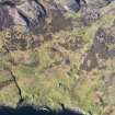
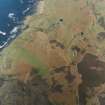
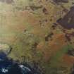
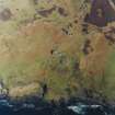
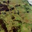
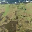
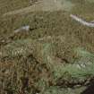
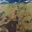
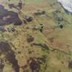
Oblique aerial view of the township at Grulin, Eigg, taken, taken from the SW.
View in Canmore
View in Canmore

RCAHMS publication drawing; plan of Grulin township. North to top.
View in Canmore
View in Canmore

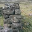
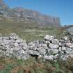
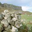
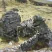
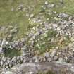
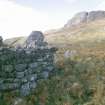
Eigg, Grulin Uachdrach, Township. View of building showing rubble-core wall.
View in Canmore
View in Canmore

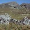
Eigg, Grulin Uachdrach, Township. View of building from S.
View in Canmore
View in Canmore

Eigg, Grulin Uachdrach, Township. View of building from NW.
View in Canmore
View in Canmore

Oblique aerial view centred on the remains of the township, field-system, rig, lazy-beds, dun and shepherd¿s bothy, taken from the SE.
View in Canmore
View in Canmore

Oblique aerial view centred on the remains of the township, field-system, rig, lazy-beds, dun and shepherd¿s bothy, taken from the E.
View in Canmore
View in Canmore

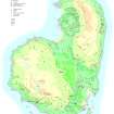
Archaeological map of Eigg, produced for the RCAHMS Broadsheet Eigg: the archaeology of a Hebridean landscape
View in Canmore
View in Canmore

Eigg, Grulin Uachdrach township, view from N.
View in Canmore
View in Canmore

Eigg, Grulin Uachdrach, Township. View of building (EIGG01 210) from SW.
View in Canmore
View in Canmore

Eigg, Grulin Uachdrach township, view from N.
View in Canmore
View in Canmore

Eigg, Grulin Uachdrach, Township. View of township from N.
View in Canmore
View in Canmore

Eigg, Grulin Uachdrach, Township. View of township from N.
View in Canmore
View in Canmore

Eigg, Grulin Uachdrach, Township. View of enclosures and field bank.
View in Canmore
View in Canmore

Eigg, Grulin Uachdrach, Township. View of building (EIGG01 230) from SSE, showing drain.
View in Canmore
View in Canmore

Eigg, Grulin Uachdrach, Township. View of kiln barn from NW.
View in Canmore
View in Canmore

Eigg, Grulin Uachdrach, Township. View of township from NW.
View in Canmore
View in Canmore

Oblique aerial view centred on the remains of the township, field-system, rig, lazy-beds, dun and shepherd¿s bothy, taken from the WSW.
View in Canmore
View in Canmore

Oblique aerial view centred on the remains of the township, field-system, rig, lazy-beds, dun and shepherd¿s bothy, taken from the SSW.
View in Canmore
View in Canmore

Eigg, Grulin Uachdrach township, view of building from SW.
View in Canmore
View in Canmore

Eigg, Grulin Uachdrach, NM48SE 7, Ordnance Survey index card, Recto
View in Canmore
View in Canmore

Eigg, Grulin Uachdrach township, view from N.
View in Canmore
View in Canmore

Eigg, Grulin Uachdrach, Township. View of township from N.
View in Canmore
View in Canmore

Eigg, Grulin Uachdrach, Township. View of building from W.
View in Canmore
View in Canmore

Eigg, Grulin Uachdrach, Township. View of building (EIGG01 219) from SE.
View in Canmore
View in Canmore

Eigg, Grulin Uachdrach, Township. View of building (EIGG01 226) from SW.
View in Canmore
View in Canmore

Eigg, Grulin Uachdrach, Township. View of SE corner of building.
View in Canmore
View in Canmore

Eigg, Grulin Uachdrach, Township. View of building from NW.
View in Canmore
View in Canmore

Oblique aerial view centred on the remains of the township, field-system, rig, lazy-beds, dun and shepherd¿s bothy, taken from the SW.
View in Canmore
View in Canmore

View of buildings 213 and 212 at the S end of the township, looking E.
View in Canmore
View in Canmore

Eigg, Grulin Uachdrach, Township. View of drystone-dyke incorporating a natural outcrop.
View in Canmore
View in Canmore

Eigg, Grulin Uachdrach, Township. View of building from NE.
View in Canmore
View in Canmore

Oblique aerial view centred on the remains of the township, field-system, rig, lazy-beds, dun and shepherd's bothy, taken from the NNE.
View in Canmore
View in Canmore

RCAHMS survey drawing; plan of township at Grulin.
View in Canmore
View in Canmore

Eigg, Grulin Uachdrach, Township. View of township from N.
View in Canmore
View in Canmore

Eigg, Grulin Uachdrach, Township. View of building from NE.
View in Canmore
View in Canmore

Eigg, Grulin Uachdrach, Township. View of building from N.
View in Canmore
View in Canmore

Eigg, Grulin Uachdrach, Township. View of kiln barn from above.
View in Canmore
View in Canmore

Eigg, Grulin Uachdrach, Township. View of building from SW.
View in Canmore
View in Canmore

Oblique aerial view centred on the remains of Grulin Uachdrach township, Eigg, field-system, rig, lazy-beds, dun and shepherd's bothy, taken from the NE.
View in Canmore
View in Canmore

Eigg, Grulin Uachdrach, Township. View of township from N.
View in Canmore
View in Canmore

Eigg, Grulin Uachdrach, Township. View of building from SW.
View in Canmore
View in Canmore

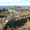
Eigg, Grulin Uachdrach, Township. View of corn-drying kiln and buildings from SE.
View in Canmore
View in Canmore

Eigg, Grulin Uachdrach. Robert Adam taking a survey photograph.
View in Canmore
View in Canmore

Oblique aerial view centred on the remains of the township, field-system, rig, lazy-beds, dun and shepherd's bothy, taken from the NE.
View in Canmore
View in Canmore

Eigg, Grulin Uachdrach, Township. View of township from N.
View in Canmore
View in Canmore

Eigg, Grulin Uachdrach, Township. View of buildings from SE.
View in Canmore
View in Canmore

Eigg, Grulin Uachdrach, Township. View of SE corner of building.
View in Canmore
View in Canmore

Oblique aerial view centred on the remains of the township, field-system, rig, lazy-beds, dun and shepherd¿s bothy, taken from the NNE.
View in Canmore
View in Canmore

Eigg, Grulin Uachdrach, NM48SE 7, Ordnance Survey index card, Recto
View in Canmore
View in Canmore
You may copy, display, store and make derivative works for personal use or use solely within an educational institution by staff and students, under these conditions: the ScotlandsPlaces website is attributed, there is no commercial use or sale, and no public distribution (for example, by hand, email, or web). Full licence details.
Details
Organisation: Historic Environment Scotland (HES)
Alternative name(s): Upper Grulin
Canmore ID: 22191
Site type: Corn Drying Kiln (post Medieval), Enclosure(s) (post Medieval), Field System (post Medieval), Hut(s) (post Medieval), Kiln Barn (post Medieval), Mound (period Unknown), Township (post Medieval)
County: Inverness-shire
Parish: Small Isles
Council: Highland


