OS1/25/17/29


| List of names as written | Various modes of spelling | Authorities for spelling | Situation | Description remarks |
|---|---|---|---|---|
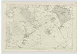
| SIDLAW HILLS | Sidlaw Hills Sidlaw Hills Seedlaw Hills Sudlaw Hills Sidla Hills Sidlaw Hills Seidlaw Hills Seid Laws Seid Laws Seid Laws Seid Laws Sidlaw Hills Sidlaw Hills |
New Statistical Account Fullarton's Gazeteer Fullarton's Gazeteer Fullarton's Gazeteer Old Statistical Account Chalmer's Caledonia Pennant's Tour of 1772 Mr Clarke Writer Factor Mr Boyd Writer Coupar Angus Mr Chalmers Buttergask Mr James Macbeth late Factor Knoxes' Map of the Basin of the Tay Johnstone's Coy. [County] Map |
087 | "The Sidlaw Hills which commence in the parish of Kinnoul here assume considerable elevation. Sid or Sud, in the Gaelic, signifies South, a name most appropriate, as they form not only the boundary of Collace on the South, but also of a great part of the valley of Strathmore. Ranging north-east, they traverse the country with little interruption for 30 miles, and lose themselves in the German Ocean, at the promontory in Inverkeilour parish Forfarshire called the "Red Head" New Statistical Account "A long ridge or chain of heights, extending north-eastward and east-north-eastward from Kinnoul Hill, on the left bank of the Tay, in the immediate vicinity of Perth, to a point a little distance south-east of the town of Forfar; they there fork into two lines, the one of which goes off in undulations and detachments, yet with very observable continuity nearly eastward to the sea at Redhead, while the other proceeds irregularly north-eastward, becomes almost lost in the vicinity of Brechin, and afterwards rallies and straggles on along the Lowland side of the How of Kincardine to the sea at Stonehaven. Such in extent are the Sidlaws in the large and properly geographical sense ; though, in the popular application |
Continued entries/extra info
[Page] 29Transcribers who have contributed to this page.
Trondragirl- Moderator, GMB
Location information for this page.
Linked mapsheets.